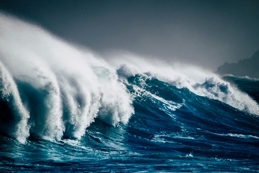
The Meteorology, Climatology, and Geophysics Agency (BMKG) has announced that high sea waves, potentially hazardous to navigation, are forecast to impact various Indonesian waters from July 31 through August 3, 2025.
According to BMKG’s official website, which was cited on Thursday, waves reaching heights between 2.5 and 4 meters are likely to develop in parts of the Indian Ocean. This includes the western coasts of the Mentawai Islands, Bengkulu, and Lampung.
Similar wave conditions are also expected in the southern waters of Banten, West Java, the Special Region of Yogyakarta, Central Java, and East Java, as well as the western, central, and eastern sections of the Arafura Sea.
Moderate Wave Activity Across Broader Maritime Zones
In addition to areas facing high wave activity, several other maritime regions are forecast to experience moderate waves ranging from 1.25 to 2.5 meters. These include the northern section of the Malacca Strait, the Indian Ocean off the western coasts of Nias and Aceh, and the southern Indian Ocean near West Nusa Tenggara, Bali, and East Nusa Tenggara.
Further inland seas such as the Java Sea, Flores Sea, Bali Sea, Banda Sea, and Seram Sea are also expected to experience waves within this range. The Karimata Strait, Makassar Strait, and northern Pacific Ocean near Papua are similarly included in the forecast.
Strong Wind Patterns Accompany Wave Activity
BMKG reports that wind speeds over Indonesian waters are contributing significantly to the potential for wave formation. In northern Indonesian waters, wind is generally blowing from the east to southeast at speeds between 4 and 25 knots. In southern waters, wind is predominantly from the southeast to southwest, with speeds ranging from 6 to 30 knots.
The highest wind speeds have been observed in several regions, including the Indian Ocean west of Aceh and Lampung, the southern Pacific Ocean near Banten, the Arafura Sea, and the Karimata Strait.
BMKG Advises Maritime Operators to Remain Vigilant
BMKG has urged caution among operators of small boats, fishing vessels, and ferry services. The agency emphasized that high waves and strong wind patterns could pose serious risks to maritime operations. Coastal communities and those engaged in marine transportation are advised to monitor weather updates and heed any further warnings.
Forecast Remains in Effect Through August 3
The current forecast period remains in effect until August 3, with no extensions announced as of now. BMKG continues to monitor wave and wind patterns across the affected regions and will issue further updates if necessary.